
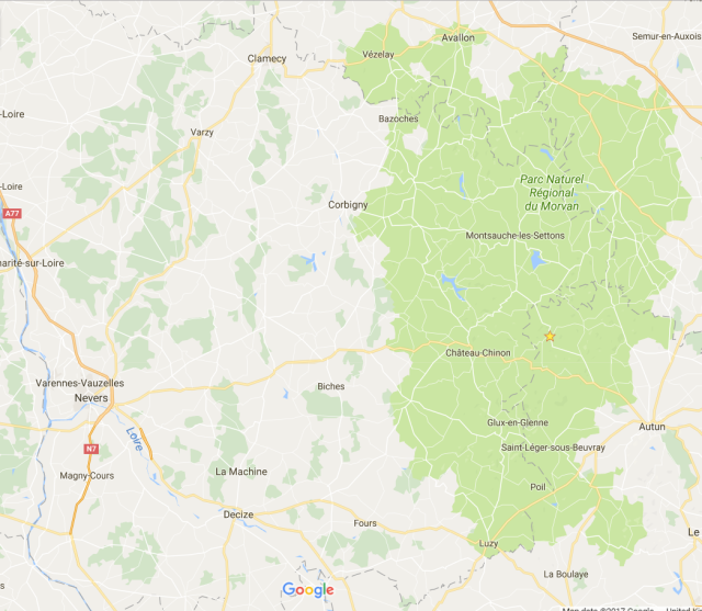
Morvan
Avallon, Bonin, Ouroux-en-Morvan,St-Honore-les-Bains,Nevers
- Equipment: bike – Ridgeback – Velocity – back to old trusted after the accident
- Back panniers – Altura – Dryline – they are waterproof – tested. Couple of bibs, 2 cycling shirts, Chamois cream – Butt’r and Ozon – both great. One winter and one summer cycling jersey. Clothes change – one shirt and one pair of 3/4 trousers that I could use in the evening after the cycling. Leg warmers. Waterproofs – jacket. Sunblock – SPF 30
- Camping tent – Terra Nova Voyager Superlite, Therm-A-Rest Prolite Plus mattress, Eris 250 Sleeping Bag by Gelert
- Primus – EtaPower EF – Cooking system – here
- HTC 10 – fantastic navigation through more difficult moments, photos and blogging. Absolutely great! Supported by Anker PowerCore 20100 Battery pack – here
- Some interesting numbers – for me:
Trip distance: 1069 km
Ride time: 69 hours
Avg speed: 15.48 km/h
Max speed: 56.61 km/h
Total Altitude Ascending: 12105 m – this is going up the height of the Everest nearly 1.5 times from the Sea level.
Day 1 21/08/2017
Twickenham, St Pancras, Calais
Trip dist: 44.93 km
Ride time: 2.52.21
Avg speed: 15.64 km/h
Max speed: 27.42 km/h
Avg cadence: 70
Max cadence: 90
Alt Asc: 79 m
Dist Asc: 2.68 km
Start of a new adventure. Trip 20 km from Twickenham to St.Pancras hectic. So much traffic in London. So many people. Loads of shopping going on on Bond Street. Train 13.37 to Dover. Will make more decisions once in Dover. So far so good.
Arrived to Dover without any problems. It was a nice train trip. 16.44 waiting for the ferry to get going. Hopefully weather is good on the other side of the channel.
Well no. It was raining in Calais. Arrived late to the campsite and kissed the door. So booked in quickly for the F1 hotel.
Not fully prepared for the trip. Going with the flow can be rather tricky.


Got in time to get quick shopping in Auchan. Salad, ham, sparkling water and a bottle of decent wine – €6.79. For goodness sake!
Tomorrow hopefully to Avallon or there about – somewhere sunny.
Day 2 22/08/2017
Calais-Frethun, Paris-Nord – Paris Bercy, Avallon
Trip dist: 27.04 km
Total dist: 71 km
Ride time: 2.18.51
Tot ride time: 5.11
Avg speed: 11.68 km/h
Max speed: 34.28 km/h
Avg cadence: 60
Max cadence: 90
Avg power: 91 W
Alt Asc: 195 m
Tot alt asc: 275 m
Dist Asc: 6.21 km
Tot dist asc: 8 km
Tot alt down: 319 m
Tot dist down: 10 km
Early start to the day. Was up and running at 7. Quick shower and trip to Calais-Frethun. Massive fog. The condensation just settled on me. Visibility maybe 100m. Train to Paris-Nord. Then across to Paris-Bercy.
Sun came out 20 minutes before arrival to Paris. It was lovely there. 24°C. Cycled through Place de la République, Place de la Bastille, Viaduc d’Austerlitz. Took the wrong turn only once. Got to Bercy in a good time. Spot of breakfast. Now on the train to Avallon. Skies are blue.
Auxerre – and the temperature is 27°C.
Avallon – 20 past 7 27.8°C. Great weather. Sun setting down slowly. Had the lunch/supper in the campsite. Tried my new Primus cooker. Excellent job. Will see tomorrow morning how long it will take to boil the water for the coffee.


Same as last year. Loads of Dutch people in the campsite. Not many other. Tomorrow exploring Morvan Natural Park.
Day 3 23/08/2017
Avallon, Lormes, Brassy, Marigny-l’Eglise, Quarré-les-Tombes, St.Germain-des-Champs, Avallon
Trip dist: 88.55 km
Total dist: 160 km
Ride time: 5.26.56
Tot ride time: 10.38
Avg speed: 16.25 km/h
Max speed: 48.78 km/h
Avg cadence: 72
Max cadence: 96
Avg power: 115 W
Alt Asc: 1253 m
Tot alt asc: 1529 m
Dist Asc: 35.41 km
Tot dist asc: 44 km
Down: 1258 m
Dist down: 35.93 km
Tot alt down: 1577 m
Tot dist down: 46 km
Avg HR: 148
Max HR: 172
Calories: 6321 kcal
First 28 km to Lormes constant uphill. Around 2-4%. Gone up 446m over 16km. Down 236m over 8 km. There was no flat so I would add another 2 km to uphill. Feel rather slow and sluggish on the road.
Haven’t been cycling much since the accident. Hopefully legs will wake up at some point. Lormes – beautiful little town. Looks like it has seen better days. Loads of shops closed. Property for as little as 38.000€.
I think the cheapest coffee yet on my trips. 1.20€. and a good coffee.
Rather grey start to the day. Baguette for the breakfast. Will keep me going for a while.
It has been a nice day in the saddle. Loads of going up. Just put the lowest gear and go. Suffered a bit, but got myself going.
Beautiful places here. Similar to Lormes the rest of villages were very empty and loads of buildings abandoned.
There was a Circus in Brassy. They had a camel, a Bactrian camel, huge it was. Beautiful animal. And there was a cow with huge horns, Ankole-Watusi – I think.
Sun came out at 16.00. when I was getting back to Avallon.


All washed. Dinner cooked. Today mushroom risotto with green peppers and beef. There was no nice chicken in Auchan.
Now to see what I am going to do tomorrow.
Day 4 24/08/2017
Avallon, Vezelay, Corbigny, Camping du Lac
Trip dist: 108.31 km
Total dist: 268 km
Ride time: 7.45.08
Tot ride time: 18.23
Avg speed: 13.97 km/h
Max speed: 56.61 km/h
Avg cadence: 64
Max cadence: 102
Avg power: 119 W
Alt Asc: 1596 m
Tot alt asc: 3125 m
Dist Asc: 37.51 km
Tot dist asc: 81 km
Down: 1477 m
Dist down: 38.07 km
Tot alt down: 3055 m
Tot dist down: 84 km
Avg HR: 144
Max HR: 166
Calories: 8539 kcal
Total calories: 14861 kcal
First day moving all the luggage around with me. Day started grey and misty. Had a baguette in the campsite. Prepared half for the road. Was out of the campsite just after 9 am. Thought I was going to do around 70 km today.
First part of the trip to Vezelay was just great. Going along the valley of the river Cousin. About 6-7km ride. Vezelay reminded me of Dinan a bit. Slightly smaller but just as beautiful. There was a festival of music happening so I had a coffee and a Coca-Cola and went back to the bike.
Road to Corbigny was tough till about 12 km to go. I had then 8km of a fantastic downhill. Then last 4 km was going up.
After Corbigny I managed to loose totally my navigation skills and ended up exploring forests in Morvan. It was great and cooling as the temperature on the road went up to 32°C. In the end managed to find my way again. All of this because of my ever trusted compass.
I realised it is showing North all the time. My handle bar bag has got magnetic clips to keep it shut. Rather strong. Compass useless. 😂
After arriving at the campsite I was notified that the shop track comes at 9am only. Had to cycle 10 km to Montigny-en-Morvan. First and last time. What a crazy uphill. 4 km 5% and this with 100km already travelled. Managed to get to the shop on time. Just before closing at 19.30. there was very little in the shop. Got spaghetti tomatoes sauce and ham.
Got back to the campsite and had a bucketful of pasta.


Camping place is on the lake and looks good to me so far. I might take it a bit easier tomorrow. Will see.
Day 5 25/08/17
Camping du Lac, Château-Chinon, Camping du Lac
Trip dist: 29.32 km
Total dist: 297 km
Ride time: 2.19.59
Tot ride time: 20.43
Avg speed: 12.56 km/h
Max speed: 46.43 km/h
Avg cadence: 59
Max cadence: 88
Avg power: 99 W
Alt Asc: 460 m
Tot alt asc: 3585 m
Dist Asc: 11.32 km
Tot dist asc: 93 km
Down: 460 m
Dist down: 12.73 km
Tot alt down: 3515 m
Tot dist down: 96 km
Avg HR: 124
Max HR: 146
Calories: 1855 kcal
Total calories: 16717 kcal
Talking about camels, yesterday I managed to drink 10 litres of water on the road.
After yesterday’s heroics today much appreciated slower day. 8am was up. Van came to the campsite at 9.20. Had a baguette with some ham and a coffee. Did the washing and attended to the bike. Cleaned and lubricated cables. Gears weren’t working well yesterday. All this was finished by 12.30 so I set off to Château-Chinon. About 14km from the camp.
Most of the way to the town was up. Which was great considering that I was going to get some shopping done. It was a nice little town. Spent some time wandering around and then went for a coffee. Got some shopping done and slowly went back home.
Had loads of salad and chicken breast with shallots and mushrooms. Washed all of the gear. Staying here for another day. Enquired about camping places around in tourist office. Now cheeky little beer 🍺.


Day 6 26/08/17
Camping du Lac, Montreuillon, Epiry, La Collancelle, Etang de Vaux, Canal Alnain, Chavance, Achun, Auney-en-Bazois, Blismes, Camping du Lac
Trip dist: 65.26 km
Total dist: 363 km
Ride time: 4.01.57
Tot ride time: 24.45
Avg speed: 16.18 km/h
Max speed: 50.74 km/h
Avg cadence: 66
Max cadence: 99
Avg power: 120 W
Alt Asc: 665 m
Tot alt asc: 4250 m
Dist Asc: 16.78 km
Tot dist asc: 109 km
Down: 666 m
Dist down: 18.61 km
Tot alt down: 4181 m
Tot dist down: 115 km
Avg HR: 134
Max HR: 158
Calories: 3844 kcal
Total calories: 20562 kcal
Slower start to the day. Had a melon for breakfast and then pain au chocolat with some coffee. Decided to go around the lakes and canal. Some good cycling, beautiful places, views. Took some fruit with me for the day. And a bag of Haribos.
On the way to lakes along the river Yonne temperature was kind and there was a breeze. Cool. Then the temperature went up and up.
I think it got to 33°C on the route. Along the lakes and the canal it was rather hot.
Then had to cycle back to the campsite. Mostly uphill. With the sun on my back I had to stop often to cool down in the shade of a tree. I think I sunburned the back of my head. Put sunblock on the neck but not on the hair.
Totally enjoyable experience. Don’t feel like cooking today so it will be salad tomatoes, cucumber, radishes, olives and some saucisson. Changing campsite tomorrow.


Day 7 27/08/17
Camping du Lac, Chaumard, Planchez, Ouroux-en-Morvan, Camping Les Genets du Morvan
Trip dist: 36.35 km
Total dist: 399 km
Ride time: 3.21.29
Tot ride time: 28.06
Avg speed: 10.82 km/h
Max speed: 44.86 km/h
Avg cadence: 52
Max cadence: 92
Avg power: 87 W
Alt Asc: 687 m
Tot alt asc: 4937 m
Dist Asc: 14.9 km
Tot dist asc: 124 km
Down: 470 m
Dist down: 12.30 km
Tot alt down: 4651 m
Tot dist down: 127 km
Avg HR: 128
Max HR: 150
Calories: 2704 kcal
Total calories: 23267 kcal
Yesterday after the long deliberations and planning I decided to move to a different campsite. Lady in Chateau-Chinon told me that there was a camping in Planchez.
After a breakfast – scrambled eggs with mushrooms and generous portion of salad I managed to get out of the camp.
First part of the route took me along the lake I was staying by. The dam holding the water was huge. I cycled all the way from the bottom of the dam to the top and ten along the lake.
After Chaumard it was time to leave the lake and go up to Planchez. Consistent and constant uphill of 5-6% all the way. Beautiful route and somehow not very exhausting.
At the beginning of the ascent I was going along the stream but then the stream was much lower. It caught up with me later. So I had the sound of water and bird songs for company.
In Planchez I went to the campsite and I just didn’t like the look of it. So after another discussion with myself I suggested that on the route there were a few signs for Ouroux-en-Morvan and all the special things they have got.
Quick turn around and I was on the road again. After going up to Planchez I thought it will be downhill all the way. But no. I was going up and up and up. I didn’t mind. It was only a short trip today.
Got to Ouroux-en-Morvan and the camping about 14.30. Set up the tent had a shower. Got water and electricity on my pitch. Actually there is electricity and water on all the pitches in the camp.
There is a restaurant as well and I think I should try some local cousin.


Excellent day.
Day 8 28/08/17
Ouroux-en-Morvan, Montsauche, Gouloux, Saut de Gouloux, Saint-Brisson, Roche, Moux-en-Morvan, Les Settons, Montsauche, Ouroux-en-Morvan
Trip dist: 66.68 km
Total dist: 466 km
Ride time: 4.31.44
Tot ride time: 32.38
Avg speed: 14.72 km/h
Max speed: 42.51 km/h
Avg cadence: 66
Max cadence: 94
Avg power: 110 W
Alt Asc: 955 m
Tot alt asc: 5893 m
Dist Asc: 25.36 km
Tot dist asc: 150 km
Down: 952 m
Dist down: 27.16 km
Tot alt down: 5604 m
Tot dist down: 155 km
Avg HR: 132
Max HR: 158
Calories: 4211 kcal
Total calories: 27478 kcal
Hot, very hot.
Beautiful day in the sun. It was a bit too hot but entirely enjoyable. I don’t know how it happens or why? Normally here or in UK or Poland I’m just feeling permanently hot. The moment I get on the bike – it is as something gets transformed in my body and mind and I can go through the blistering sunny road just keep me watered.
Woke up at 6.30 this morning just to see the most pink sunrise. Don’t get to see sunrises very often so my trips are a great experience. Went back to sleep though and got up around 8.30.
Quick trip to the shop. Got some fruit and eggs and tomatoes. Plenty of sparkling water.
Back to the campsite and breakfast was ready in no time. Had a nice coffee and set off for the trip at around 10.30. Planned for about 67km. So no huge rush.
The temperature was raising constantly.
Got to the jump/waterfall Gouloux – nice place – smallish the jump but thoroughly enjoyed the sounds around the place. There was a restaurant-cafe place there. Two women behind the bar. Sending everyone away as they don’t sell coffee without the lunch. Weird.
Then got to the park in St-Brisson. There were a few deer smelling very deery. Had a quick browse through the park and around the big house. The café-bar closed as well.
Then had a good ride through lovely valley to Moux and from there to lake Les Settons.
Wanted to stay around the lake for a bit but it was mosquito infested and I didn’t have my repellent. So took few pictures and run away.
the way back in Montsauche there was 36°C in the shade. So easily 40+ on the road in the sun.
Back in Ouroux-en-Morvan bought some more fruit as all was delightful in the morning.


Now all washed and showered going to have something to eat.
Day 9 29/08/17
Ouroux-en-Morvan, Planchez, Anost,Le Pommoy, Gorges de la Canche, Glux-en-Glenne, Arleuf, Les Gardenias, Arleuf, Athez, Anost, Planchez, Ouroux-en-Morvan
Trip dist: 102.61 km
Total dist: 569 km
Ride time: 7.08.13
Tot ride time: 39.46
Avg speed: 14.37 km/h
Max speed: 48.97 km/h
Avg cadence: 65
Max cadence: 98
Avg power: 105 W
Alt Asc: 1720 m
Tot alt asc: 7613 m
Dist Asc: 40.85 km
Tot dist asc: 191 km
Down: 1725 m
Dist down: 40.38 km
Tot alt down: 7330 m
Tot dist down: 195 km
Avg HR: 133
Max HR: 157
Calories: 6679 kcal
Total calories: 34158 kcal
Hot, very hot, again.
Planned yesterday for a slightly more challenging tour for today.
Woke up at 7am. Got up 7.30. Had the breakfast. Nice eggs again. And was ready to roll at 9 am. Started – went 2.5km up and realised I forgot the mobile on the camp when I wanted to take a photo.
As it was going to be more challenging tour I thought it would be a good idea to have it on me. Help with navigation and obviously photos. Started doing some video as well so dropped down to the campsite picked it up and was going again at 9.30.
First part of the trip through Planchez to Anost was very enjoyable. Half way between Planchez and Anost there was a downhill marked 10% officially. I was happy it was on the way down for me.
Beautiful village Anost. Could have stayed there on the camp it was placed in a very beautiful spot.
After Anost decided to take a tour through the Gorges de la Canche and Le Haut Folin. Gorges were pretty by a very small dam. Then it was up and up first 2-3% then coming to 10-11 towards the end of the mount.
After getting nearly to the top before turning back to camp I got a bit ambitious and decided to go to the top. It was great. Some beautiful views from the top of the mount.
As a consequence of the decision I was going to have a longer trip than expected. As I was getting out of water and energy, so decided to take a detour to Glux-en-Glenne. Had a coffee and a Coca-Cola and replenishment of water. To my surprise I found, not discovered, on the foot of Mont Preneley just a few km from Glux the source of the river l’Yonne that has been present throughout this trip.
Trip to Arleuf was rather nice but I started feeling a bit tired with nearly 70 km in my legs. Started going from Arleuf on the D500 but after couple of km decided that it will be too much for me today. Met a lady picking up blackberries. She helped me with the decision. Went back to Arleuf – challenging 10% uphill on the way back.
Then it was damage limitation. As I changed the route I realised I will have to go up the hill marked officially 10% from Anost to Planchez. I wasn’t looking forward to it. But slowly, slowly, slowly I was getting up and up. Before I knew it and my legs gave up I was passing the 10% sign again.
Challenging 5km uphill but somehow got there.
Once up it was a known road. Not that it was not challenging just not as steep. Got back to Ouroux-en-Morvan just before 19.00. Got some nice fruit and vegetables for later and the morning.
All washed and showered, sipping Grimbergen. Getting back human again.


What a great day in the saddle. Challenging, exhausting, absolutely cracking and amazing at the same time.
Higher up there were pine forests. It was hot and the sticky, amazing smell of the pine was there for most of the day.

Loved it.
Day 10 30/08/17
Ouroux-en-Morvan, Chaumard, Château-Chinon, St-Leger-de-Fougeret, Onlay, St-Honore-les-Bains
Trip dist: 52.11 km
Total dist: 621 km
Ride time: 3.33.15
Tot ride time: 43.19
Avg speed: 14.66 km/h
Max speed: 41.53 km/h
Avg cadence: 64
Max cadence: 95
Avg power: 108 W
Alt Asc: 699 m
Tot alt asc: 8312 m
Dist Asc: 16.99 km
Tot dist asc: 208 km
Down: 1009 m
Dist down: 26.8 km
Tot alt down: 8339 m
Tot dist down: 222 km
Avg HR: 122
Max HR: 145
Calories: 2686 kcal
Total calories: 36845 kcal
As there was a rain forecast for afternoon today I tried to leave the camp early in the morning in order to set up before the rain in St-Honore-les-Bains.
Rain started of course as I started packing in the morning. So had to wait a bit for the drizzle to stop. Even though the rain came I was out of the camp by 9.30.
First part of the road to Chaumard and Corancy was very quick and easy. From Corancy to Château-Chinon was rather steep uphill.
After Château-Chinon went through some lovely valley. Couple of tougher uphills but I was on the campsite just after 13.00.
Got a nice pitch.
Quite like this business of going around knowing that there will be a space on the camp. It is a huge place here but only a few pitches occupied.
Even though I was slower than usual with tent set up I managed to get all ready just before the rain came down. As I was leaving for the shower the sky opened.
Now 16.30 looks like I might be able to make it to the shop without getting completely wet.


Day 11 31/08/17
St-Honore-les-Bains, Luzy, Mont Beuvrey, Moulins-Engilbert, St-Leger-St-Honore-les-Bains
Trip dist: 88.29 km
Total dist: 709 km
Ride time: 5.18.57
Tot ride time: 48.38
Avg speed: 16.60 km/h
Max speed: 42.70 km/h
Avg cadence: 73
Max cadence: 103
Avg power: 119 W
Alt Asc: 1168 m
Tot alt asc: 9481 m
Dist Asc: 33.98 km
Tot dist asc: 242 km
Down: 1167m
Dist down: 33.73 km
Tot alt down: 9407 m
Tot dist down: 255 km
Avg HR: 124
Max HR: 148
Calories: 4188 kcal
Total calories: 41034 kcal
And it rained all night. The temperature dropped 20°C overnight.
Good thing I tested the tent on several occasions and it survived really well. It was still raining at 8. It stopped just before 9. Got the baguette, prepared nice breakfast and sandwich for later.
All was very slow and cold. Got the food and after the shower set off for the road. It was just before 11. Long morning.
First part of the day to Luzy – beautiful views all the way. A bit tricky with quite a few tracks on the road. Popped in to see the place. Nice little village like most of places around here. From Luzy decided to visit Astérix and Obélix. A place called Bibracte
Museum was very interesting and the whole place was showing traces of people who lived there more than 2000 years ago. Interesting is that I was thinking of places around Morvan. Current. How many of the little villages are in such a clear decline. Maybe it is the passing of history and changes in socio-economic environments that dictate what is alive and what dies.
After the visit to my childhood heroes came all the way down to Moulins-Engilbert. Kind of little Venice. Town with loads of canals and one that one could say in in decline.
Got more provisions in the shop and cycled back to the campsite.


As on the road was quite cold at moments I had a long warm shower. Then cooked my supper. The sun came out as I was cycling to Luzy. For a moment, but then when I came back to the campsite the nice surprise was that all my washing from last night was dry.
Success.
Day 12 1/09/17
St-Honore-les-Bains, Vandenesse, Cercy-la-Tour, Decize, on the road, Cercy-la-Tour, Limanton, along canal, Moulins-Engilbert, St-Honore-les-Bains
Trip dist: 92.44 km
Total dist: 801 km
Ride time: 5.01.17
Tot ride time: 53.40
Avg speed: 18.41 km/h
Max speed: 46.22 km/h
Avg cadence: 72
Max cadence: 95
Avg power: 154 W
Alt Asc: 639 m
Tot alt asc: 10121 m
Dist Asc: 17.88 km
Tot dist asc: 259 km
Down: 623 m
Dist down: 23.29 km
Tot alt down: 10131 m
Tot dist down: 279 km
Avg HR: 119
Max HR: 155
Calories: 3634 kcal
Total calories: 44668 kcal
Colder night last night.
I had to use the sleeping bag. Just as a quilt but still.
In the past few days I have seen loads of interesting creatures by the road.
Apparently, black squirrel, the mix of grey and fix is invading this part of France. I saw a little red squirrel today. I have seen some black ones in the forests though.
As I cycle around I could hear some bird of prey shouting for the past few days. Yesterday as I was getting to the top of the mount I saw one. Huge bird. He was just below me and just went on a magnificent glide through the valley to the next tree.
It was magnificent.
Today I saw a huge water rat. The Coypu. It was dead unfortunately but a massive thing.
Last few days the left arm. The one that was broken was causing a bit of pain in the morning. Fortunately the pain was away half way through the day.
Today’s tour took me to Decize and Cercy-la-Tour. One way on the road and then back along the canal.
The weather was absolutely crazy today. Sun in sun out. Hot cold. Beautiful blue sky blue heavy black clouds.
It wanted to drizzle couple of times but it passed by. The path along the canal was relatively decent but at some points the headwind was so strong I had to hold on to the bike. Unbelievable.


Apparently this region of France is a birdwatchers paradise. I can see why. I just saw so many different species from the tiniest to the huge crane and the eagle.

By the lakeside with bats there were a few woodpeckers. Saw couple of big green ones.
Day 13 2/09/17
St-Honore-les-Bains, Tussy, Sanglier, Let Puits, Larochemillay, Chiddes, St-Honore-les-Bains
Trip dist: 57.74 km
Total dist: 859 km
Ride time: 3.36.39
Tot ride time: 57.18
Avg speed: 15.99 km/h
Max speed: 50.93 km/h
Avg cadence: 68
Max cadence: 93
Avg power: 149 W
Alt Asc: 979 m
Tot alt asc: 11100 m
Dist Asc: 21.6 km
Tot dist asc: 281 km
Down: 982 m
Dist down: 25.82 km
Tot alt down: 11113m
Tot dist down: 305 km
Avg HR: 129
Max HR: 158
Calories: 3125 kcal
Total calories: 47800 kcal
Rain came in the early hours of the morning. Decided to stay in the campsite. There was no point of packing all of the wet stuff and complicating things here.
Had breakfast on the roof terrace and coffee from the bar. No cooking.
About 12 rain started slowing down a bit and I decided to go for a ride. Up the Mont Beuvrey. Crazy idea.
As I left the sun came out and I was getting worried about the sunblock I didn’t put on. Went up the first Mont Genievie. Not sure about the name. Can’t read on the map. Took a picture of a very distant black cloud on the horizon. Few minutes later I was cycling back to escape the mayhem. I didn’t. I was wearing all of the layers I had with me. Waited under the tree. The black cloud came and went in 30 minutes or so. Sun came out again. Got to Let Puits and the heavens wanted to open again. There were black clouds coming and going in all directions. It was insane.
Mont Beuvrey is only 821 and there is another higher Haut Folin at 901 next to it. The rain was coming down and as soon as it was done the white cloud started then in 5min there was a back massive raising and pushing new rain.
Got back to Larochemillay with the rain.
Then as I turned in direction of the St-Honore-les-Bains sun came out again. I pushed a bit harder on the pedals and got to the campsite to find that my washing from yesterday was dry.
As soon as I put the washing in the tent and picked up shower gel and change of clothes on the way to shower heavens opened again.
Massive rain and 15 minutes later the sun was up. 15 minutes later there was a huge thunder and 2 minutes later I was finishing my cooking in the little entrance to the tent. 15 minutes later the thunderstorm and was over and I think this has cleared the air a bit.
Day of insane weather. Totally insane.


Didn’t see the big eagle today. I could hear him around but no visual contact. But I saw a peregrine falcon and another couple of birds of prey: one flying in the sky and the other came down to the ground and stayed there for a while. Probably hunting.
Day 14 3/09/17
St-Honore-les-Bains, Cercy-la-Tour, Imphy, Chevenon, Nevers
Trip dist: 66.84 km
Total dist: 926 km
Ride time: 3.3805
Tot ride time: 60.56
Avg speed: 18.38 km/h
Max speed: 46.82 km/h
Avg cadence: 73
Max cadence: 99
Avg power: 73 W
Alt Asc: 471 m
Tot alt asc: 11572 m
Dist Asc: 14.71 km
Tot dist asc: 296 km
Down: 507 m
Dist down: 18.28 km
Tot alt down: 11621 m
Tot dist down: 323 km
Avg HR: 125
Max HR: 147
Calories: 3005 kcal
Total calories: 50806 kcal
Early morning start to the day. Started drying the tent at 8 am. Slow breakfast and constant turning of the roof part of the tent on the sunny bit of the camp. Little by little it was getting better. Absolutely soaking wet it was in the morning. On the top from the rain and on the bottom from condensation. By 10.30 I had it really well dry.


Set of at 11.00 or there about. I knew the first part of the road today. Then after Cercy-la-Tour I went through the beautiful valley right to Imphy. Then went to catch the canal in Chevenon.


Very straight forward trip to the campsite in Nevers. It was nearly empty when I arrived at 15.00. There was a Suisse guy Bernard setting up the tent and that was it for the bottom part of the camp. Now it is full.
Bernard Is biking from Geneva to Bordeaux. Very nice guy and had some pretty cool gadgets for his trips.
Staying here in Nevers tomorrow. Probably will go along the canal and pass through Magny-Cours.
Tickets back to UK booked for Tuesday.
Went to visit St Bernadette church in Nevers – Wiki. Quite an architectural feature. Pics to follow. Google images


Sleeping on the bank of river Loire!
Day 15 4/09/17
Nevers, Decize along the canal, Avril-sur-Loire, Fleury-sur-Loire, St-Patrize-le-Châtel, Magny-Cours, Chevenon, Nevers
Trip dist: 91.56 km
Total dist: 1018 km
Ride time: 4.28.16
Tot ride time: 65.24
Avg speed: 20.47 km/h
Max speed: 43.1 km/h
Avg cadence: 73
Max cadence: 102
Avg power: 100 W
Alt Asc: 334 m
Tot alt asc: 11906 m
Dist Asc: 10.66 km
Tot dist asc: 306 km
Down: 333 m
Dist down: 11.8 km
Tot alt down: 11954 m
Tot dist down: 335 km
Avg HR: 127
Max HR: 154
Calories: 3845 kcal
Total calories: 54652 kcal
Got up just before 8am. Had a sandwich and a coffee. Had a little chat with Bernard. He set off about 10.30 and I had a little lazy hour. After the shower I went for a ride as well. Started around 11am. Went back to the canal. This is the Canal latéral à la Loire. Cycled along the canal to Decize.
Although cycling along the canal is nice it gets quite similar after a number of kilometres.
In Decize I took the road running back along the canal. Much better. There was a bit more of excitement some up and down the hill.
After St-Patrize-le-Châtel got to Magny-Cours. Couldn’t get to do the lap of honour but the tarmac around the place was absolutely divine. It is quite impressive the place. Took a few pictures and went back to the canal in Chevenon and back to the campsite. Did a little shopping on the way. Last supper in the campsite. Managed to use up the gas cartridge.
Tomorrow early wake up call. Train at 6.57 to Paris.


A little moan. I didn’t do much of it this time. I know already track drivers don’t give a toss about everybody else. This is obvious in every single country. They just steam ahead. If you end up in a ditch or under their wheels tough luck.
What really gets to me are the motorbikers. Not those going on proper stuff. The ones that sound godallmighty bass at 70km/h. And they enjoy the ride. Those are fine. The ones that really annoy me are those who think they are Valentino ‘F***ing’ Rossi. Going always above the speed limit and always on top of the revs. Get a grip, you don’t sound great you sound bloody stupid. Like a freaking annoying mosquito or a wasp. The other day I had to get into a ditch as a group of 20 or so Valentino’s was overtaking me at full speed in pairs with traffic coming from opposite direction. Idiots. The end.
Variations on sunset


Day 16 5/09/17 – what a freaking day
Nevers, Paris-Bercy, Paris-Nord, Calais-Frethun, Calais Port, Dover Port, Dover Priory, London St Pancras, Twickenham
Trip dist: 51.42 km
Total dist: 1069 km
Ride time: 3.42.45
Tot ride time: 69.07
Avg speed: 13.85 km/h
Max speed: 35.45 km/h
Avg cadence: 61
Max cadence: 89
Avg power: 65 W
Alt Asc: 200 m
Tot alt asc: 12105 m
Dist Asc: 6.93 km
Tot dist asc: 313 km
Down: 210 m
Dist down: 7.18 km
Tot alt down: 12164 m
Tot dist down: 342 km
Avg HR: 127
Max HR: 154
Calories: 3845 kcal
Total calories: 54652 kcal
My smart phone was very smart until this morning. Obviously my mistake I didn’t check the alarm call during the trip at all. It turns out that the phone was going to wake me up British time.
So I booked the train for 6.57 in the morning. That’s OK. I set the alarm for 5.45. I was hoping to have a shower in the morning as well. Well…
After the very restless night. I couldn’t sleep. I was concerned about the early morning train I guess. I managed to get to sleep at 3 am. Then woke up at 5. Had few more minutes.
Next thing I woke up it was 6.35. Blind panic. 20 minutes to the departure of the train. I have to say a few swear words came out of my mouth. It is still pitch dark in the campsite, I’m trying to put my pants on and can’t find the correct leg. Somehow I managed to put my pants on. Taking down the tent and packing everything 6.45. I thought I was with a chance of catching the train. Station was just 7 minutes away.
Lost my cycling gloves. OK. Got to the station and dragged the bike with all of the gear down and up the stairs to the platform. I even had a time to ask where the carriage is going to be. And the train arrived. The lady that managed the train told me to calm down and slow down.
Once on the train I slowly repacked the whole content of my bags. On the camp I just pushed everything in paniers.
By the time I got to Paris I was a tad calmer.
Going through Paris in the morning rush hour is quite an experience. As I had plenty of time to get to Paris-Nord I cycled at a leisurely pace. I have seen guy in suit riding through the craziest traffic making a call from a mobile phone. Not earphones. Holding the mobile.
I saw a few ladies with long coat going on the bike with high heels. There are loads of scooter people in Paris. This are crazy as well.
At Paris-Nord had a coffee and a sandwich. Outside there was a bit of action with police and a guy in burger king. They went into the shop and instantly managed to get the guy.
After this I was ready to catch the train to Calais-Frethun. Only to realise that the same train was going to Dunkirk. I just hoped I was in the right carriage. Got to Calais OK. Cycled my way to the ferry port. It is a challenge to find the way through the maze.
Got a ticket for the ferry at 16.05. Back in UK 16.35. By the time I got out and to the station I was catching the 17.49 to St Pancras.
The train was on time and I set up the Google maps to take me back around the regents canal. What a wonderful way to the end of the trip.
The richness of characters living on the canal is absolutely amazing. The changes in the economic power is very noticeable as you leave the centre of the town
Unfortunately afterwards I had to face the traffic around North and South Circular but once over this going along Kew gardens and back to Richmond was really nice. Dropped all the stuff in the flat and quickly went to get some shopping.
Flat looks like a bomb site. All my gear hanging from every possible door. Thanks God my flatmate is away on holiday.
The end.
